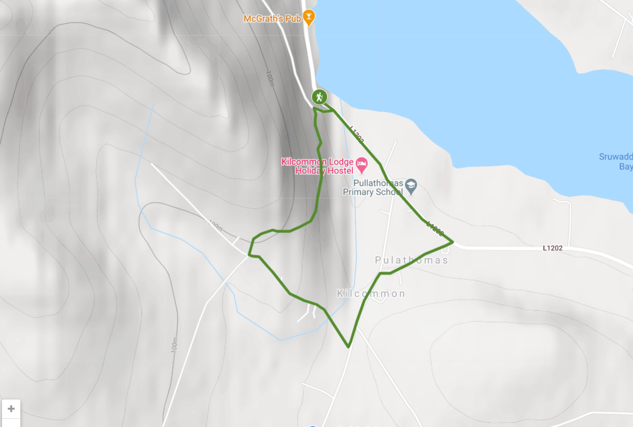
Pullathomas Loop Walk
Location: Pullathomas
Start / Finish / Trailhead: Graveyard Carpark
Distance: 3.1km
Total Ascent: 94m
Maximum Elevation: 103m
Terrain: Rough Tracks, country road and Paved Road
Trail Waymarking: Black Post 1 metre high with a Green travel arrow highlighted
Level of Difficulty: Easy – Moderate (just to note a short steep incline at the start
Map Reference: OS Discovery Series 22
Minimum Gear: Sturdy Walking Shoes / Boots, Waterproofs, Mobile Phone, Snacks & Fluids
Services: Pullathomas Village, Belmullet Town
These loops are part of a countrywide network of high-quality, circular walks being developed by Fáilte Ireland. The loops have been developed with the kind assistance of local landowners and organisations. It is understood that if persons enter private land they do so by permission and with the consent of the landowners and no matter how often they enter, or in what numbers, they do not do so as of any right. Further details about looped walks throughout Ireland including downloadable maps & information are available on: www.mayowalks.ie and www.mayo.ie/walking
In the event of an emergency dial: 112 or 999
We welcome feedback about your walking experience.
Please contact us at: info@mayowalks.ie or visit@mayo.ie
Leave No Trace
Principles of Outdoor Ethics
Please adhere to this code in any trips to the outdoors
- Plan ahead and prepare
- Dispose of waste properly
- Leave what you find
- Respect wildlife and farm stock
- Be considerate of others
- Minimise the effects of fire
Think Safety!
A section of this route is shared with vehicles – be aware!
Keep Children under close supervision
Take adequate clothing, food and fluid
If you encounter any difficulties, contact emergency services on 999 or 112